Skip to the content
A joint project:
Museum of Australian Democracy
&
National Archives of Australia
Create an account
or
sign in
National Archives of Australia
Discovering
Mildenhall's Canberra
Photographs from the birth of our capital
Museum of Australian Democracy at Old Parliament House
Home
Explore
the collection
Explore & search
Rephotographs
Map
Tags
Old Parliament House
Mildenhall
About
Content starts here
Explore the collection
Map
Rephotographs
Tags
Sort
Oldest to newest
Newest to oldest
Random
Go
Show date filtering
Show from
to
Go
You’re viewing
50
of
7465
total
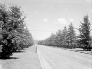
Commonwealth Avenue, West Block Offices in distance.
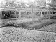
Shade house, Yarralumla nursery.
Shade house, Yarralumla nursery.
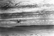
Aeroplane taking off.
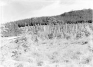
Pine plantation, Brindabella mountains on horizon.
Mr Arthur Percival, Surveyor General.
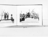
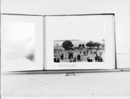
Photo of Federal Capital Ceremonial, Lady Denman "Naming the City", 1913.
The Minister for Home Affairs and Party at the Surveyors Camp, Canberra, 1913.
Photo of Federal Capital Ceremonial, Naming ceremony. View of the site from the stand, 1913.
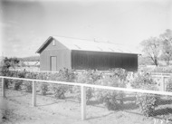
Wooden building with rose garden in front. Built in 1923 near old Acton Hospital. Was Masonic Lodge from 1926. Was moved to Russell Hill and used as Primary school.
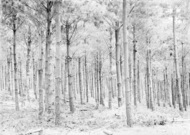
Pine tree plantation.
Weatherboard house. Liversidge Street, Acton.
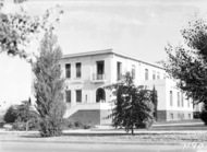
Group in Parliament House courtyard including Right Hon W M Hughes and Right Hon J H Scullin with two visiting American golfers.
East Block and Canberra Post Office from Queen Victoria Terrace.
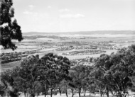
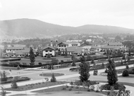
View from Red Hill over Manuka and Kingston to Duntroon. Collins Park in the centre.
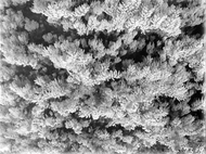
Pine forest and the road to Mt. Stromlo.
Australian War Memorial, under construction from the rear (north).
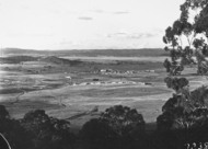
View from Red Hill to Mount Pleasant, Canberra, Kingston in centre, Collins Park in foreground
National Library, Kings Avenue, Barton
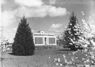
Front of Parliament House. Landscaping in front
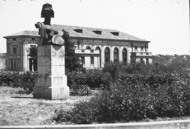
Albert Hall and bust of 'Bellona' , Roman goddess of war by Sir Bertram Mackennal
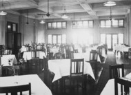
Hotel Dining room.
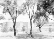
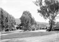
Unidentified landscape
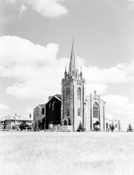
St Andrews Presbyterian Church with St. Andrews House on the left, State Circle, Forrest.
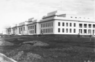
Parliament House from the north, road building in front.
St Andrews Presbyterian Church with St. Andrews House on the left, State Circle, Forrest.
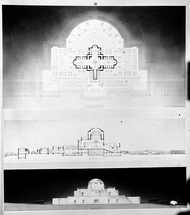
Plan and perspective of Hall of Memory for proposed War Memorial.
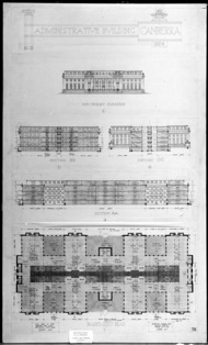
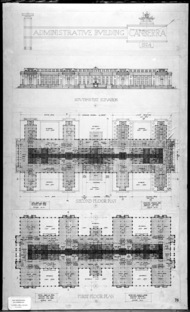
Plans for Administrative Building Canberra 1924. South East Elevation, sections and basement plan.
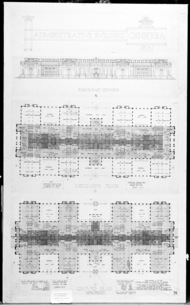
Plans for Administrative Building Canberra 1924. North West elevation, mezzanine and ground floor plans.
Plans for Administrative Building Canberra 1924. South West elevation. First and second floor plans.
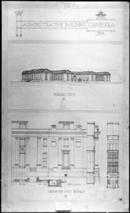
Plans for Administrative Building Canberra 1924. Perspective and quarter inch details.
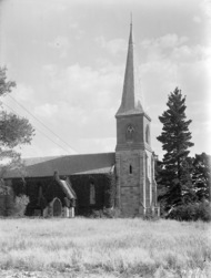
St John's Church, Constitution Avenue, Reid.
St John's Church and graveyard, front entrance, Constitution Avenue, Reid.
Hotel Canberra and Commonwealth Avenue from West Block, Black Mountain at the rear.
Wattle tree in blossom.
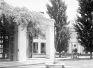
Courtyard of Parliament House.
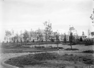
Entrance to Canberra Community Hospital.
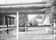
Courtyard and walkways at Canberra Community Hospital.
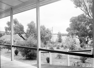
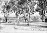
View from the Canberra Community Hospital verandah.
One of the wards at Canberra Community Hospital.
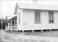
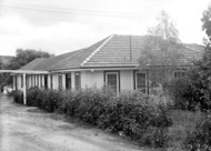
A building in the Canberra Community Hospital.
View from the ground of Canberra Community Hospital to Yarralumla.
FCC Cottage
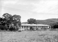
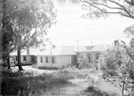
Buildings in the Canberra Community Hospital.
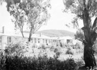
Buildings in the Canberra Community Hospital. Black Mountain behind.
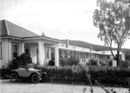
Buildings in the Canberra Community Hospital and baby Austin 7 tourer car.
Buildings in the Canberra Community Hospital.
Buildings in the Canberra Community Hospital.
Cabinet Room, Parliament House.
St John's Church and graveyard, Constitution Avenue, Reid.
Loading photographs
No more photographs to load.
‹ Prev
Next ›