Content starts here
Photo
National Archives of Australia:
Like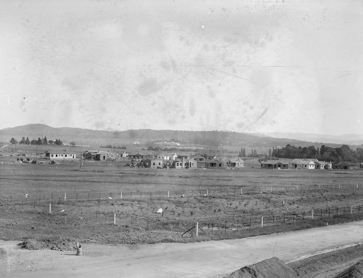
Activity:
1 comment so far.
Join the conversation
Daryn Radford
updated the location of this photograph.
Please contribute: suggest a change to the title or date, update the location, add tags, submit rephotographs, or join the conversation.
You must sign in to leave a comment. No account? Create one now.
October 8 2021
Taken from Ainslie Avenue area. The clump of trees to the right is St John's Rectory (now Cooyong St / Glebe Park), while the elevated trees to the top left mark St John's Church (Constitution Avenue / Amaroo Street). Parliament House and East Block can be seen in the distance in the centre. The small track leading from the Church to the left edge of the photo may be the road from Scott's Crossing which went from the Molonglo River past the Church to join the Yass Rd (now Limestone Ave). This is a very early photo of Reid (then called South Ainslie) since there appear to be very few houses, none of which seem to be yet inhabited. Date is possibly 1926-27.